Bridge to Nowhere
(originally to be built in Alaska)
Years ago, I was watching a couple
of well tattooed teenagers buzzing around the Caney Dead Lake near my home
in Sargent Texas on a jet ski. They must have thought the water was deep
enough when they saw me paddling nearby. Kayaks  only draw six inches, so it was not long before
I heard a resounding crash as they hit a reef. The boy was not wearing shoes,
so he insisted his girlfriend get off and push—cutting her ankles on sharp
oyster shells. I paddled over, but the girl and I could not budge the noisy
beast with him sitting on it. When she finally persuaded him to get off and
help, he angrily flipped it upside down with much cursing, cutting up its
beautiful purple padded seat and handlebars with several large yellow gashes.
After all, it was the boat's fault he got stranded, not his bad driving.
They seemed to be getting lower and lower in the water as they zoomed away,
violating no wake laws trying to get home. I do not know if they made it
back, but they undoubtedly sank at the dock if they did.
Years later, I was shopping for a chartplottrer. It was March, so I saw a Garmin ice fishing kit for half price. I have only seen ice in Sargent once in thirty years, but an ice fishing transducer is exactly what I need to glue in the bilge of my sailboat and it came with free charting software even though the charts it came with were obsolete and had to be redrawn. Equipped with its own battery and carrying case, it was small enough to fit between my knees when paddling, so I decided to try it in my kayak first. Rather than glue down the transducer, I tore the bottom off a foam can caddy of the type used to keep a beer can cold and glued it inside my kayak with 3M 5200. An inch of water was all that was needed to cover the transducer, which would not be damaged if I ran aground since it was inside the boat. At high water, I could pass over and chart the reefs without any danger.
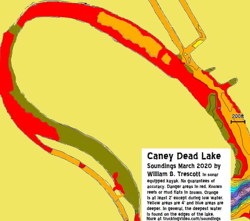
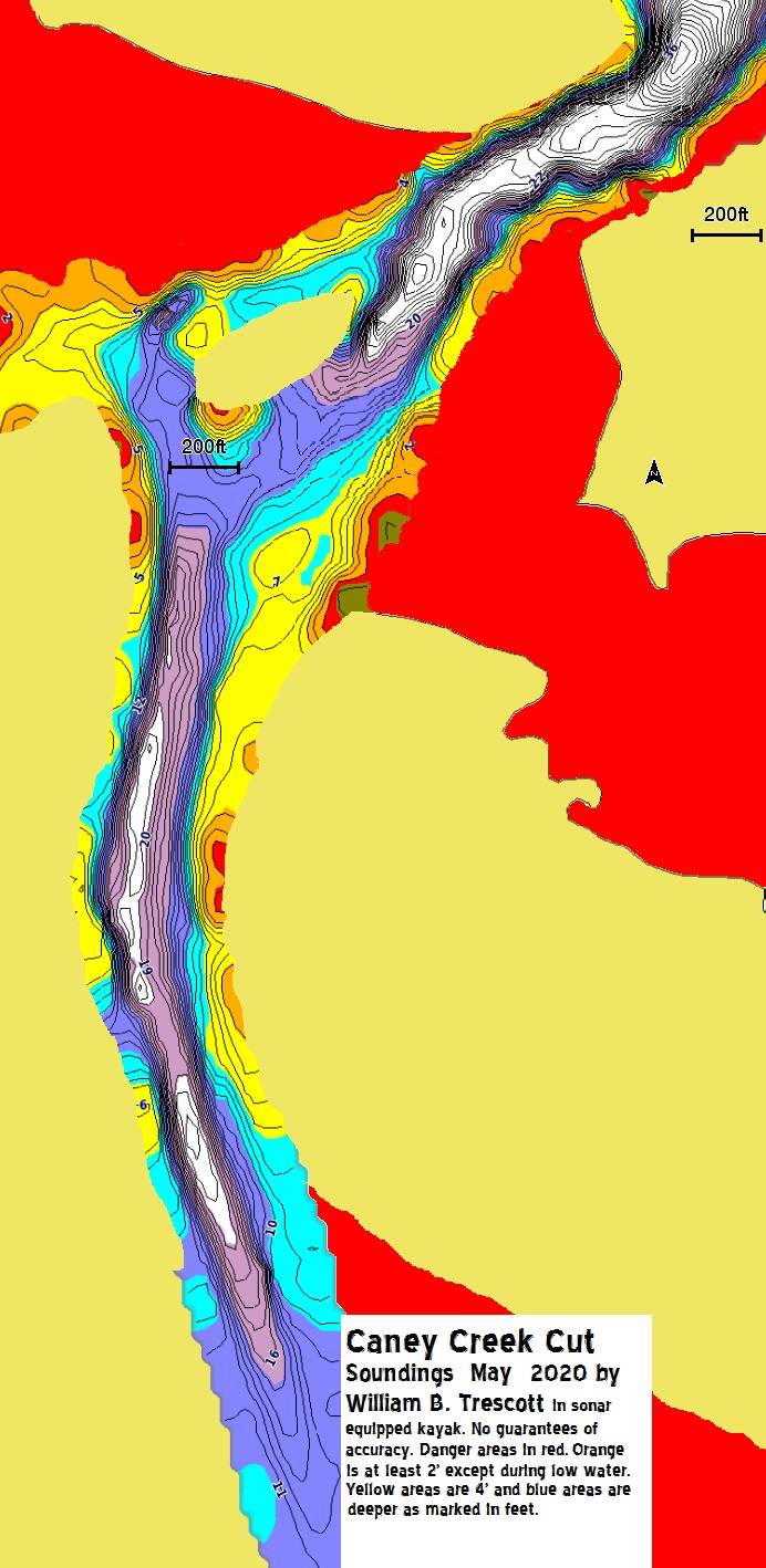
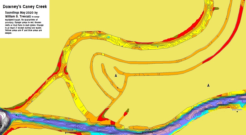
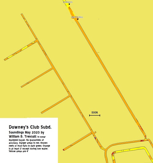
My charts are shown with depths at normal water levels. No guarantee of accuracy! Danger areas marked in red are about two feet deep except during winter and must be driven slowly as they contain uncharted reefs. Known reefs and mud flats are shown in brown. Orange areas are two to four feet deep, but still contain obstacles on the bottom left over from hurricanes. Yellow areas are four to eight feet deep and can safely be driven at high speed. The deepest water, 40 feet at high tide, is near a giant whirlpool called The Wiggles where Caney Cut meets the Intercostal Waterway.
There are numerous small fishing holes in the northern part of the Caney Dead Lake though one must be cautious probing through the red areas to get there. The Eastern part of the East Bay is deeper, but still full of obstacles. Surf prevented me from obtaining accurate reading at the entrance to the gulf.


 only draw six inches, so it was not long before
I heard a resounding crash as they hit a reef. The boy was not wearing shoes,
so he insisted his girlfriend get off and push—cutting her ankles on sharp
oyster shells. I paddled over, but the girl and I could not budge the noisy
beast with him sitting on it. When she finally persuaded him to get off and
help, he angrily flipped it upside down with much cursing, cutting up its
beautiful purple padded seat and handlebars with several large yellow gashes.
After all, it was the boat's fault he got stranded, not his bad driving.
They seemed to be getting lower and lower in the water as they zoomed away,
violating no wake laws trying to get home. I do not know if they made it
back, but they undoubtedly sank at the dock if they did.
 Years later, I was shopping for a chartplottrer. It was March, so I saw a Garmin ice fishing kit for half price. I have only seen ice in Sargent once in thirty years, but an ice fishing transducer is exactly what I need to glue in the bilge of my sailboat and it came with free charting software even though the charts it came with were obsolete and had to be redrawn. Equipped with its own battery and carrying case, it was small enough to fit between my knees when paddling, so I decided to try it in my kayak first. Rather than glue down the transducer, I tore the bottom off a foam can caddy of the type used to keep a beer can cold and glued it inside my kayak with 3M 5200. An inch of water was all that was needed to cover the transducer, which would not be damaged if I ran aground since it was inside the boat. At high water, I could pass over and chart the reefs without any danger.

My charts are shown with depths at normal water levels. No guarantee of accuracy! Danger areas marked in red are about two feet deep except during winter and must be driven slowly as they contain uncharted reefs. Known reefs and mud flats are shown in brown. Orange areas are two to four feet deep, but still contain obstacles on the bottom left over from hurricanes. Yellow areas are four to eight feet deep and can safely be driven at high speed. The deepest water, 40 feet at high tide, is near a giant whirlpool called The Wiggles where Caney Cut meets the Intercostal Waterway.
There are numerous small fishing holes in the northern part of the Caney Dead Lake though one must be cautious probing through the red areas to get there. The Eastern part of the East Bay is deeper, but still full of obstacles. Surf prevented me from obtaining accurate reading at the entrance to the gulf.

